
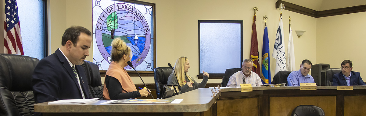
The Municipal Planning Commission/Design Review Commission met Thursday night (2.20.20) at City Hall for two developments: The Lake District and Taylor Farms Planned Development.
Link to agenda: https://tn-lakeland.civicplus.com/ArchiveCenter/ViewFile/Item/914
The sign plan for The Lake District (TLD) was tabled with no vote.
As requested during an MPC/DRC work session Feb. 5th, a logo for TLD was hoisted atop a bucket truck Monday (2.17.20) to simulate a 70-foot tower sign proposed for the 160-acre mixed use development at I-40 and Canada Road in Lakeland. Link to story: https://lakelandcurrents.com/can-you-see-this-flag/
Mayor Mike Cunningham who sits on the MPC/DRC cited three reasons he could not approve the package at the Thursday meeting:
- The paperwork on the project submitted to MPC/DRC was flawed
- No one on the MPC/DRC was informed of the time and place of the tower sign simulation
- The simulation should be lighted so it can be visible at night
During the meeting there was mention that MTAS (Municipal Technical Advisory Service) should be contacted for their opinion on the TLD sign package and the Lakeland sign ordinance. Commissioner Wesley Wright, who also sits on the citizen volunteer MPC/DRC, asked City Planner Forrest Owens to contact MTAS before the next meeting of the MPC/DRC.
A representative of A2H which is part of the design team for TLD said Mr. Owens was notified that the sign simulation was set for 1 p.m. Monday (2.17.20) on the TLD property. A spokesman at City Hall said that notice was not forwarded to MPC/DRC staff.
“We will strive to adequately notify MPC members once the crane has been placed on the site, I apologize for any communication lapses that may have impacted members from participating in visualizing the potential impacts of the landmark sign height and location,” said Shane Horn, city manager.
The next MPC/DRC meeting will be March 11th, a week earlier than normal because of spring break. A new tower sign simulation will be scheduled before the March meeting, with a light focusing on the top of the pole. It will be placed at the precise location of the proposed sign which is to be 150 feet from the interstate.
The discussion on the sign package began with Mr. Owens reviewing differences in the package since the 3 ½-hour MPC/DRC work session. He said there are changes in some of the boundaries, off-premises signs were eliminated and there is a table of all the signs.
He then turned the presentation to Maureen Yarborough with Sign Matters Inc., a partner with TLD. She explained the sign location was moved south away from the interstate from the original 75-foot placement and the flag height was set at 80-feet, even though the proposed tower sign is to be 70-feet high. She said the simulation showed the proposed sign is not the monstrosity people thought it would be.
Commissioner Wright said he drove to the Lou-Jan Causeway over Garner Lake and could barely spot the flying logo flag with binoculars. He said a pole on the horizon some mistook for the crane/logo flag was actually a TDOT camera at the I-40 exit 20.
The Mayor said he wanted to see where the sign is going to be, with the crane and a light on it at 70 or 80-feet. He said he would not approve anything as ambiguous as what was presented. He said to the presenters and TLD Developer and Owner Yehuda Netanel there is a lot more work to do.
Mr. Cunningham said he is the Mayor of the City and no one called, emailed or texted him that the crane was in place. He said he just happened to see it and was surprised at the location. He added if TLD wants to do things outside the City sign ordinance, he wants to know when it’s happening. He suggested if the sign simulation placement was botched, the rest of the package might be, too.
MPC/DRC Member Todd Laessig said he had no clue the simulation was happening. He also wondered if the 80-foot mention was a typo. He wondered if that was a discrepancy. He said the package needs some administrative work.
Mr. Netanel came to the podium and said, “I would like to table this issue until we get our act together and come back and hopefully we’ll be okay.” He said the bucket truck was brought to the site although the construction area was very muddy from the rain. He said it was made known to City staff about the simulation. There were scheduling issues because of the weather. “There was no intent to deceive anyone,” he added.
He agreed to do another simulation at night with lighting but he could not predict a date because of weather.
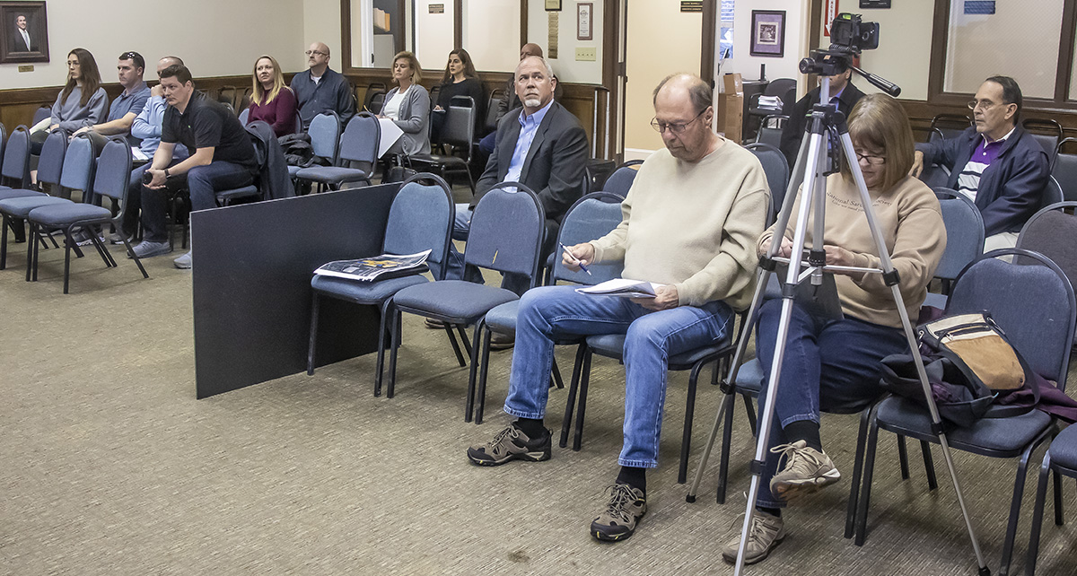
Lakeland residents John Brown and Bill Morgan once again addressed the MPC/DRC about the tower sign and package.
From Commissioner Wright:
“I highly value the input from residents on the lake and spoke in person with John Brown on Monday when the crane was up and messaged Bill Morgan.” He said Mr. Brown viewed the crane from the Causeway, the only vantage point where it might be visible.
“Both were more at ease after the demonstration. It was clear to many that the tower wasn’t as tall or intrusive as people had talked about. No one could actually see it from their house.”
Commissioner Wright said Mr. Brown said he doesn’t think it will be a problem for the lake at all. “Coming from a well-respected resident of Garner Lake, that speaks volumes,” said Commissioner Wright.
Of The Lake District, Commissioner Wright said to Mr. Netanel the development is welcome in Lakeland. “I know the development and marketing community are closely networked and I don’t want the message conveyed that Lakeland is not welcoming.”
Taylor Farms PD
The residential Taylor Farms Planned Development was reviewed by applicant Doug Swink with Renaissance Developments, LLC. He took about 45 minutes to outline the sketch plan of the proposed 76-acre development.
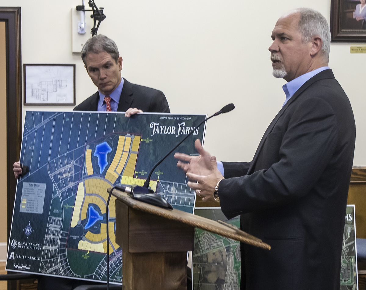
The property is bound to the east and south by The Grove, the west by Oakwood Grove, and the north by estate lots along Memphis Arlington Road.
The planned residential development is to be 165 single-family residential lots with 24+ acres of common space including walking trails, benches, ponds, guest parking and tree preservation areas that will be utilized by residents in the development as well as connect to other adjacent neighborhoods. The proposed lot sizes will range from 50-foot wide to 90-foot wide as delineated by the site data table. The proposed overall density is 2.1 dwelling units per acre.
The property was previously called Equestria PD, first approved in October 2007 with a later amendment in 2010 and a second amendment in 2013.
Commissioner Wright voiced some concerns about the project:
- A road connecting northward to Memphis- Arlington to alleviate circulation of construction and resident traffic through The Grove and Oakwood Grove.
- Increased buffers on the eastern perimeter
- Discussion with adjacent owners on what they thought they were getting with Equestria
- Increase lot sizes along north eastern perimeter
- Reduced density with fewer 50-foot lots
- Separate from the Sketch Plan a Speed Limit Sign (like the Canada one) on Maple Walk and perhaps another road
Owners from Oakwood Grove attended the meeting and resident Bill Sheridan addressed their concerns. He said he is not against the project but hopes it will move forward in a sensible manner.
Susan Mitchell, MPC/DRC chair, said the purpose of the Taylor Farms discussion was to receive feedback and there would be no vote.
…Photos by Jim Willis, Lakeland Currents


